
By Donna Anderson and Paul Haseman
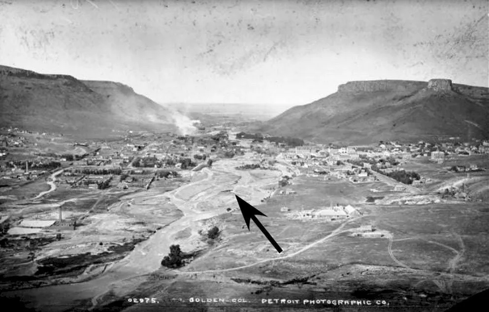
Before about 1870, the Clear Creek channel through central Golden was wide, with sand bars intertwined like braids. A braided channel pattern is common where a stream channel changes from a confined zone, as in the inner gorge of Clear Creek, to a broader unconfined area. As streamflow spreads out at the mouth of a canyon, the water cannot carry as much sediment, so the sediment drops out, or is deposited, commonly into a series of braided sand and gravel bars.
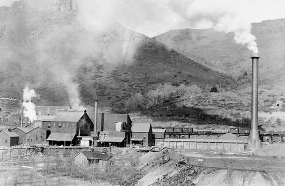
Since the 1880s, Clear Creek channel has been greatly modified. First modified in the late 1870s and 1880s, Coors Brewery built large ice ponds on the south side of the channel, east of Washington Street. Gold dredging from 1904 to 1908 further modified the Creek channel east of Coors Brewery leaving behind large piles of boulders and cobbles from gold dredging operations. Eventually Clear Creek was completely straightened to become a flood-control channel through the Clear Creek Valley east of the Ford Street Bridge. West of Ford Street, human activity gradually modified the original sand bars (Fig. 51) of Clear Creek.
In 1886, hydraulic gold mining near the canyon mouth filled-in the channel with sediment from those operations (Chapter 8). The City of Golden built its water-supply ponds along the channel on the north side of the Creek in the late 1800s. The Creek channel was further filled in to create the western end of 11 th Street around the time that the Mines Experimental Plant was built in 1912. When US Hwy-6 was constructed at the canyon mouth in 1950, bridging Clear Creek required narrowing the channel below the highway. At the time, like many rivers in the U.S., Clear Creek was viewed as more of a flood-control channel (and an open sewer) rather than an amenity that people might enjoy. However, in 1998, the channel was restored for recreation by creating bends and pools within the channel between the US Hwy-6 and Ford Street bridges, forming the now-very popular kayak run and open-space trails on either side of the Creek.
This was an excerpt from Golden Rocks: The Geology and Mining History of Golden, Colorado by Donna Anderson and Paul Haseman.
The authors have granted me permission to reprint excerpts, but I recommend that you read the whole book. You can buy a copy from the Lulu website, borrow one from the library (there’s a waiting list!), or read it online for free.
