
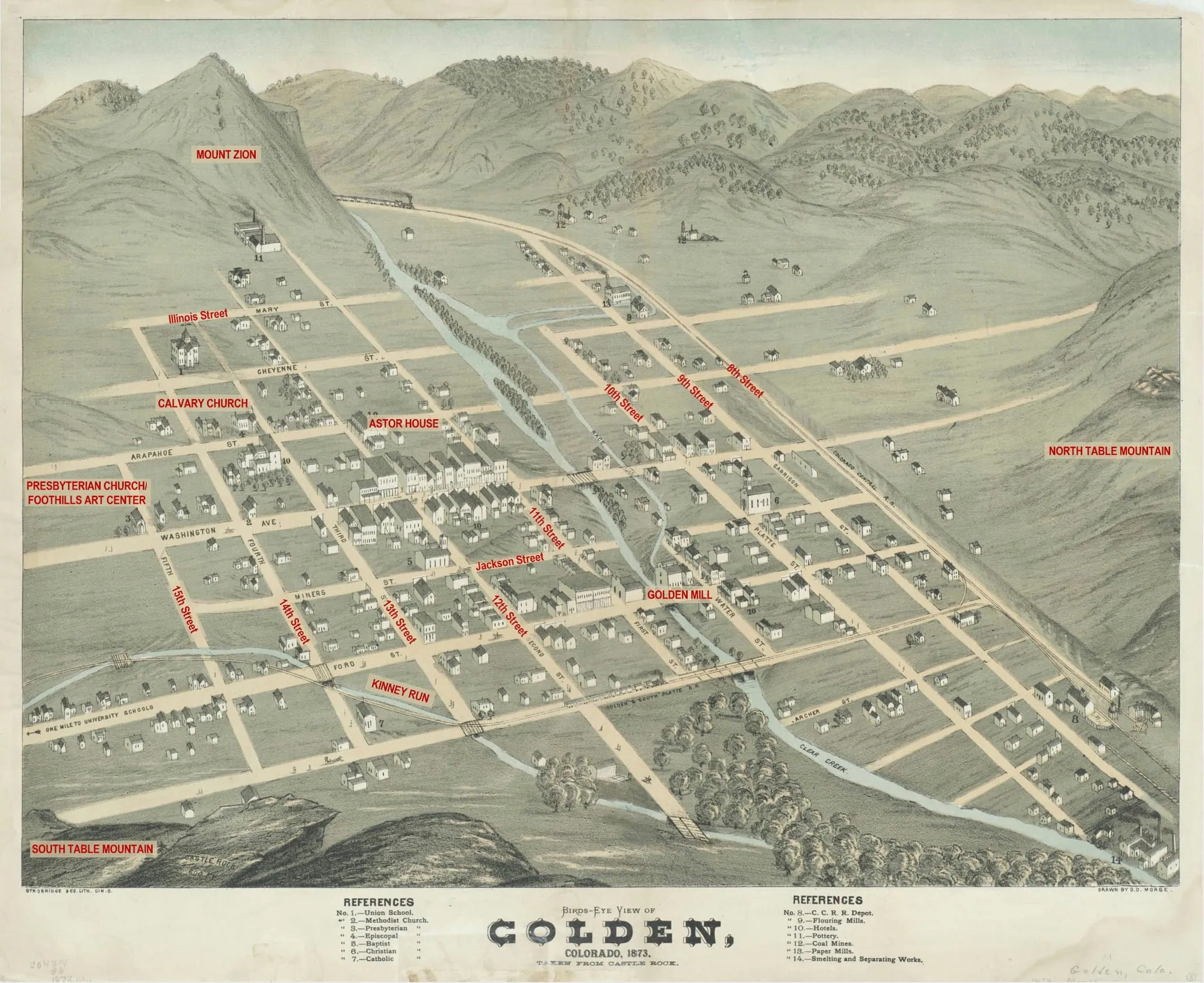
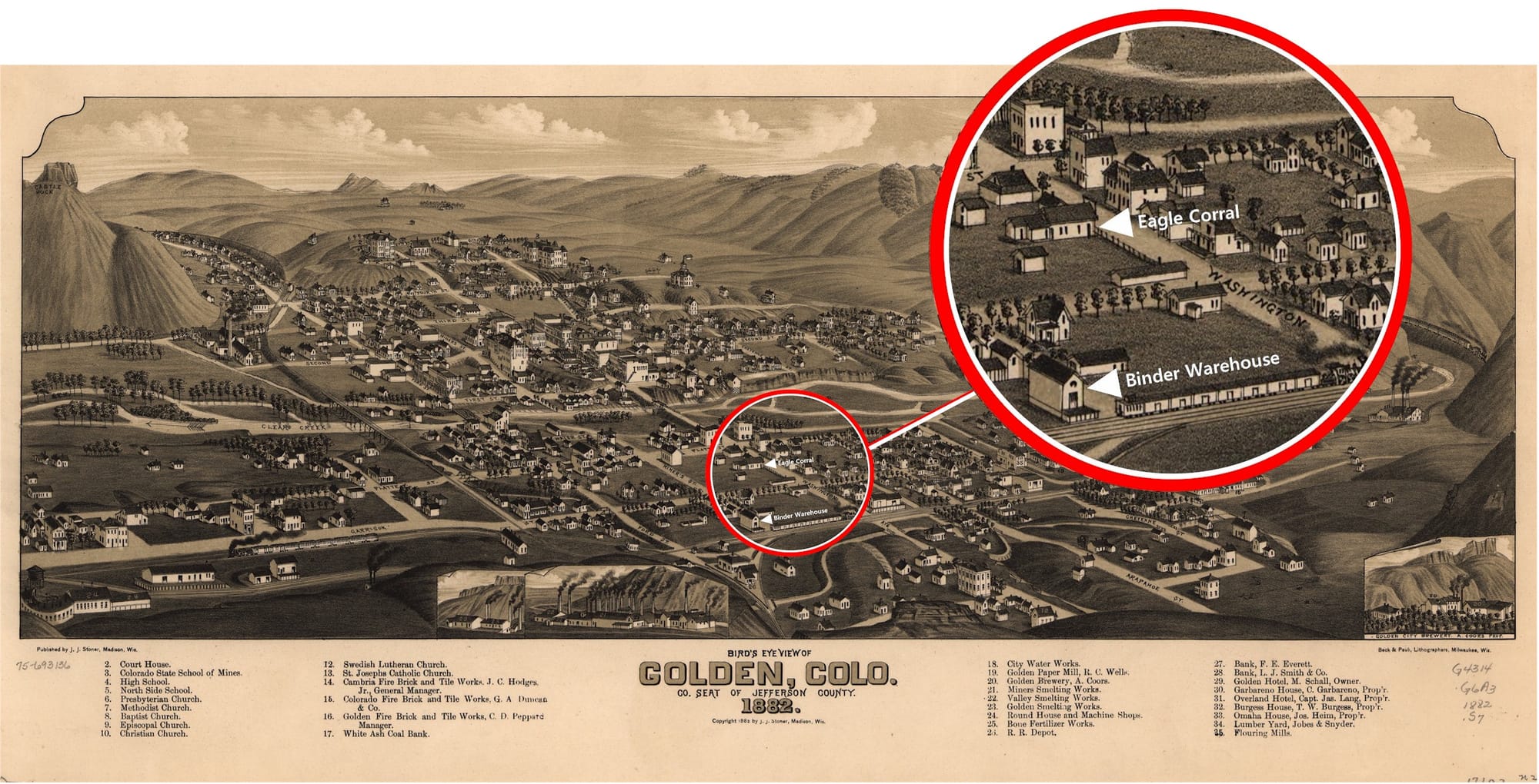
I often use excerpts from the 1882 Birdseye Map of Golden (the brown one, below) to show buildings from our early days. The one above is even earlier–1873!
The railroad was here by 1873, but you’ll notice that the School of Mines isn’t there yet. The large building on the Mines campus was the new Golden School–elementary through grade 12, all in the same building. A few years later a second school was built on the north side of the Creek, and after that they were called North School and South School. Both the North and South Schools were demolished in 1965.
Several of the buildings on the west side of Washington Avenue were there already–the Loveland Building (Old Capitol Grill), Atomic Cowboy at 11th & Washington, the Everett Building (now Goozell Yogurt), the Harrison Block (Creekside Jewelers). The Astor House appears on the 1873 map, as does Calvary Church and the Presbyterian Church (now Foothills Art Center).
Notice the mill race running parallel to the Creek on the north side. It powered two flour mills and a paper mill. The creekbed was much wider in the 1870s. Since that time, we’ve made the channel deeper and built up the land on both sides through downtown.
Enjoy the map!
