


Commanding the Grandest Scenery of the Rock Mountains
148 Years Ago
The April 5, 1876 Colorado Transcript included an advertisement for scenic excursions through Clear Creek Canyon on the Colorado Central Railway.
Considered by all who have visited it to be the most wonderful Railway in the word, winding its serpentine course, as it does through this wild Canon, with perpendicular walls upon each side that are in places over two thousand feet in height.
Colorado Transcript - April 5, 1876
Thanks to Bill Robie, inveterate collector of antique postcards relevant to Golden's railroads, we have a wonderful record of what early passengers would have seen. Bill wrote and provided the graphics for the following story:
GOLDEN TO “INSPIRATION POINT”
Early 1900 Clear Creek Canyon postcards were always of the railroad and the various passenger and freight trains that used the line. Construction west of Golden began in August, 1871, as the Colorado Central and the line was finally abandoned and dismantled as the Colorado & Southern in 1941.
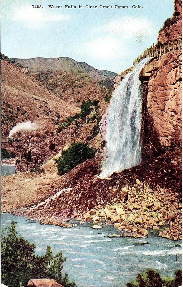
This interesting postcard shows water from the Welch Ditch overflow weir cascading down into Clear Creek. The location is just west of Golden near the present-day entrance to Hwy 6 Tunnel No. 1. Just visible on the left side of the view is a small section of the railway track and a steam locomotive drawn in by hand. Photographers, from which the postcards were usually made, almost never waited around for a train to come. They just took the image and had the train drawn in later back in the studio.
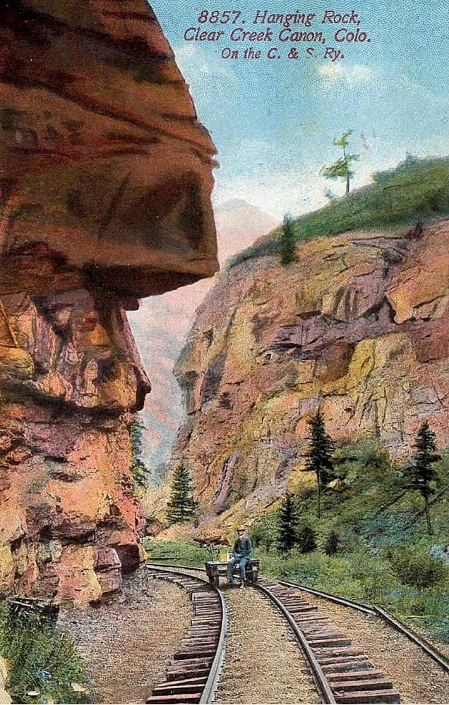
“Hanging Rock” was the first railroad feature customarily photographed west of Golden. The location, looking up the canyon in this view, is now under Hwy 6 on the south bank of Clear Creek about 1/2 mile before the entrance to Tunnel No. 2.
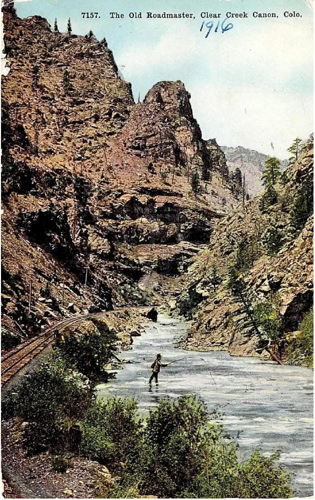
In this view looking west, a short distance beyond “Hanging Rock”, the track is on the south bank of Clear Creek and now under Hwy 6. Around the curve to the right is the entrance to Tunnel 2 right after the highway crosses to the north bank of clear creek. “The Old Roadmaster” rock pinnacle stands tall in the upper portion of the view.
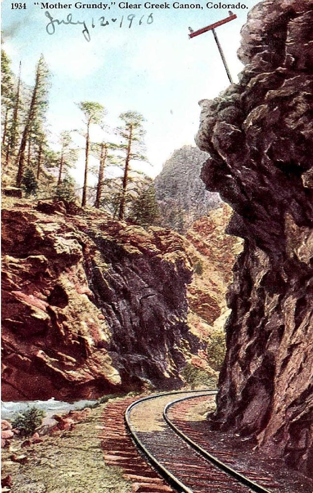
“Mother Grundy” was named for the face silhouette on the rock wall in this view on the south bank of Clear Creek looking down the canyon. The location is opposite the entrance to Tunnel 2 where the uphill track curves left to enter the portion of the canyon now bypassed by the tunnel which would be to the left of this view on the north side of the Creek.
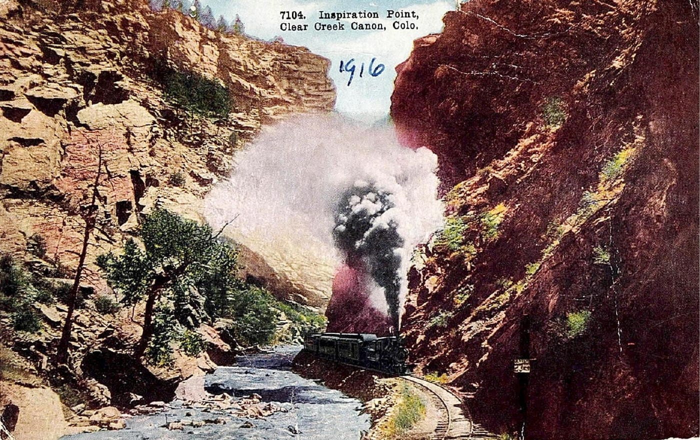
“Inspiration Point” was in the section of the canyon bypassed by Tunnel 2 which bores through the rock ridge on the left side of this view. The train is heading west along the south bank of Clear Creek. An average track grade in the canyon of almost 2% and nearly continuous curves required the small locomotives even with short trains to work very hard. The firemen must have constantly shoveled coal into the boiler to keep the steam pressure up producing tall columns of dark gray smoke. The noise reverberating between the canyon walls must have been intense.
BEAVER BROOK TO FORKS CREEK
Just beyond “Inspiration Point”, in this artist’s view looking down the canyon, was the Beaver Brook station at the point where Beaver Brook enters Clear Creek. This location is also in the canyon section bypassed by Tunnel 2. Scheduled train time for the 7.6 miles from Golden to Beaver Brook was 45 minutes in 1882.
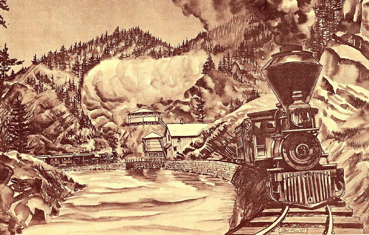
Beaver Brook station, on the south bank of Clear Creek, with its large pavilion perched on the hillside along with other entertaining attractions, was a popular destination for day-tourists, weekenders, and host for many “merry” events. Locomotives could also replenish their water supply here from the trackside water tank.
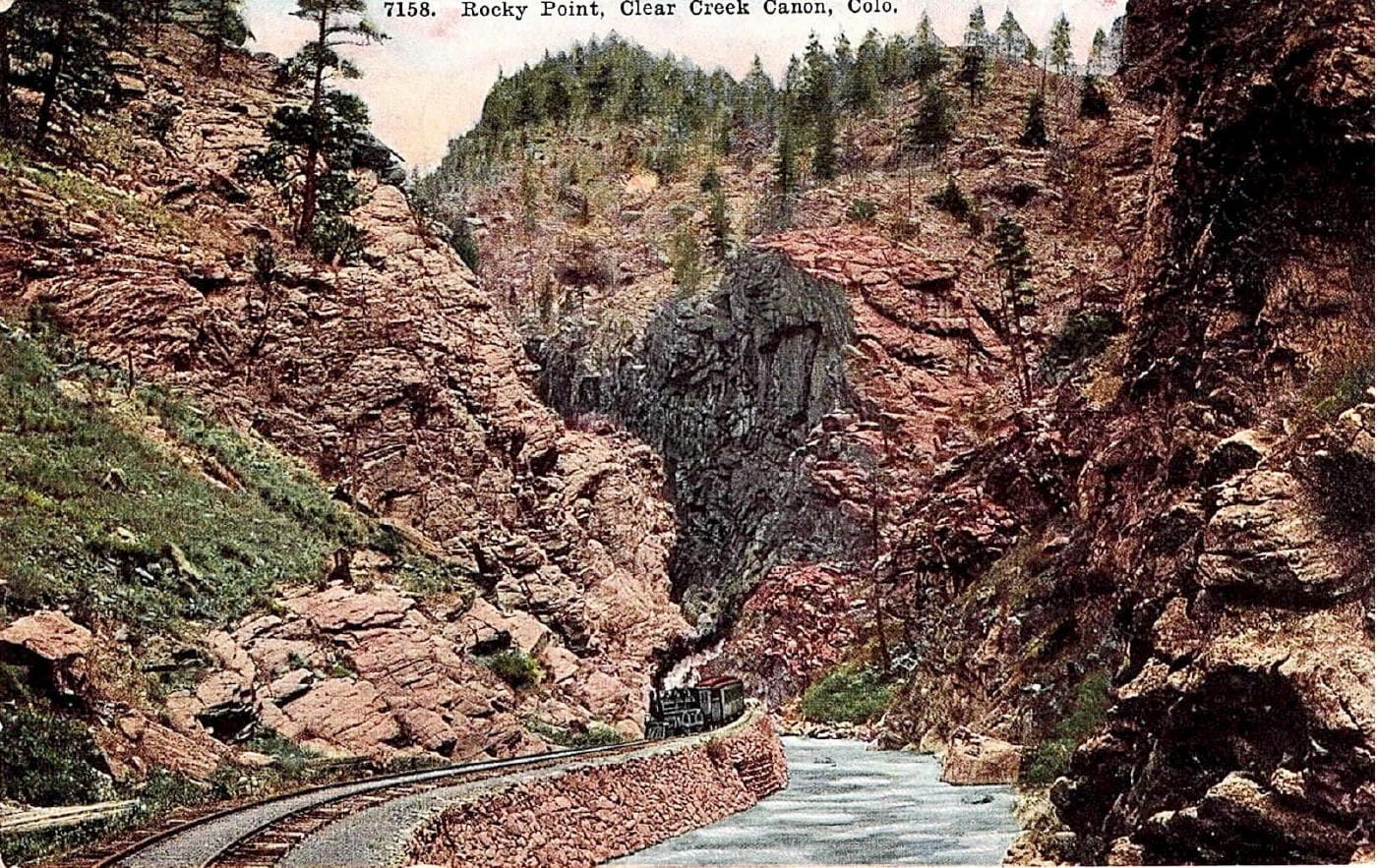
A little further along was “Rocky Point” located on a sharp, right curve nearly opposite the uphill end of Tunnel 2 which would be to the left in this view looking down the canyon. Notice the long section of dry-stack rock retaining wall common throughout the canyon to support the roadbed. Also notice the superimposed hand-drawn locomotive and train.
To be continued tomorrow….
Many thanks to Bill Robie for this detailed progression through Clear Creek Canyon and sharing these rare and interesting postcards!
)