


Part 1 of Bill Robie's tale of early travels through Clear Creek Canyon appeared yesterday. Today, we continue on to the dramatic climax at the Georgetown Loop.
The view above, looking down the canyon, shows the three huge boulders called “The Three Brothers” on the north bank of Clear Creek. The location is a mile or so west of both the west end of Tunnel 3 and where Elk Creek empties into Clear Creek. The elevated grade of Hwy 6 in this area places most of the boulders under the highway fill.
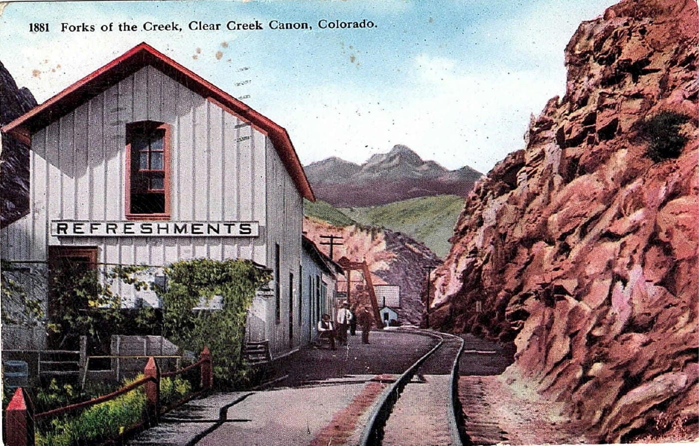
This view is looking up the canyon just prior to where Hwy 119 heading to Blackhawk now diverges from Hwy 6. This was another popular spot for refreshments as the trains stopped here before proceeding to either Black Hawk and Central City or to Idaho Springs and Georgetown. Notice the embellishment of craggy mountain peaks to make the view more spectacular.
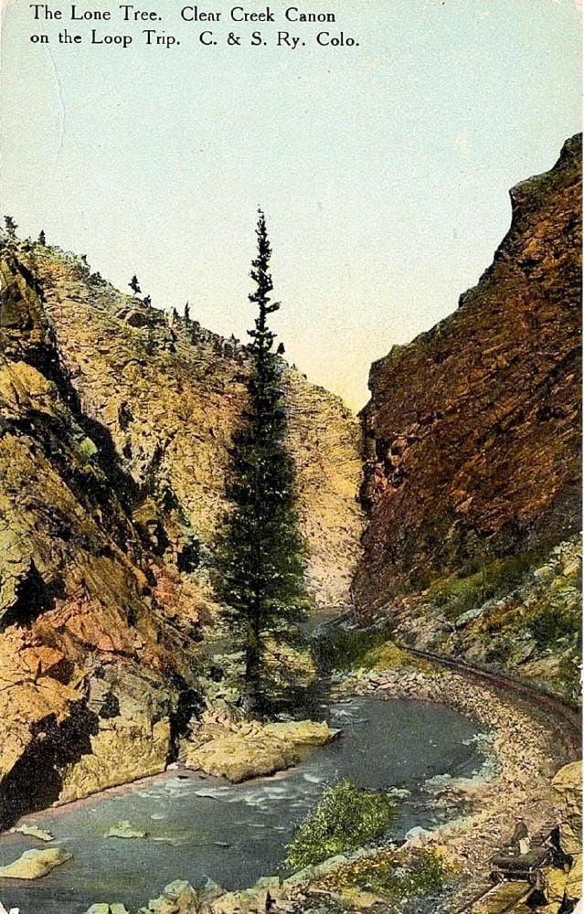
Further up the canyon from Forks Creek, in this view looking downstream, is “The Lone Tree” on the north bank of Clear Creek. The location is about opposite the east entrance to Tunnel 6.
Many sections of the old railroad grade can be seen today on the opposite side of Clear Creek from Hwy 6, or even walked along by accessing segments of the new Peak to Plains Trail.
GEORGETOWN LOOP POSTCARDS
The Colorado Central Railroad reached Georgetown on August 14, 1877. The line went no further until 1884 when the Union Pacific subsidiary, Georgetown, Breckinridge and Leadville, began construction west with the intention to tunnel under the continental divide and, according to its name, reach Leadville. Silver Plume, a little more than 2 miles straight line from Georgetown was about 642’ higher, creating a grade far too steep for a railroad. The solution was to design an alignment with many sharp reversing curves and a full “loop” which allowed the track to cross over itself. The track distance between the two towns was about 4.2 miles and the average grade was about 2.8%.
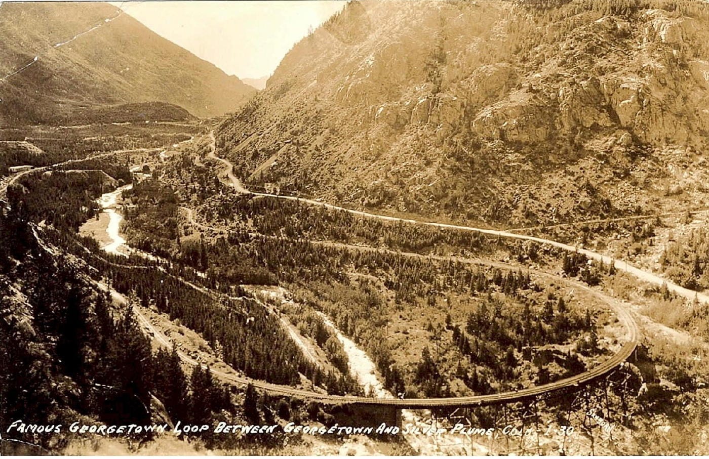
This is an unretouched photo image of the Georgetown Loop valley from a very frequently used view point.
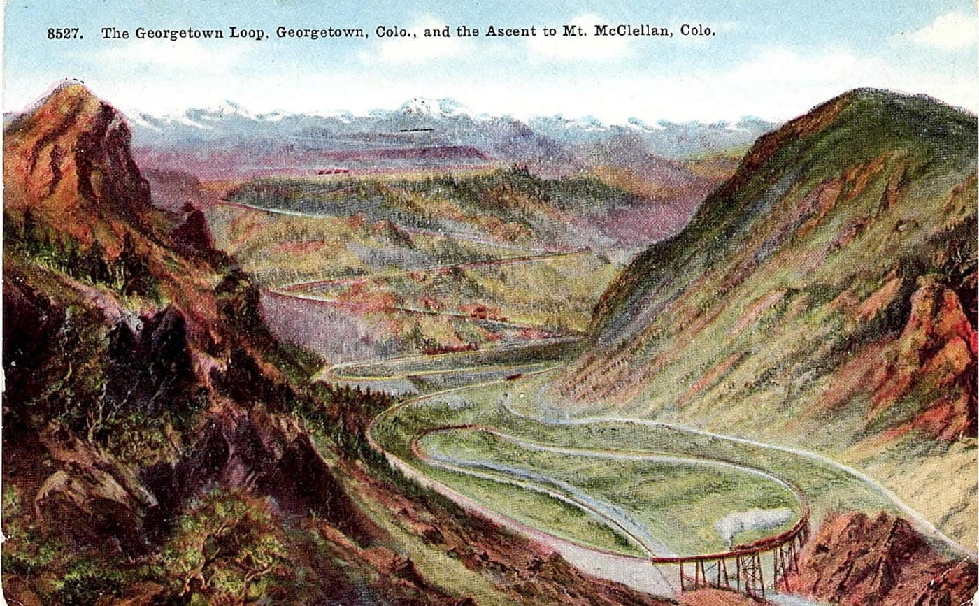
This highly embellished postcard is viewed from a location a little further distant than the photo above. Almost all elements have been either modified or simply added by hand. The entire central background is artistically created. The track shown switchbacking up the side of the fabricated mountain in supposed to be the Argentine Central, but the alignment actually went up the north-facing side of the mountain to left, out of view. Also note the added snow-capped range of Rocky Mountains on the skyline.
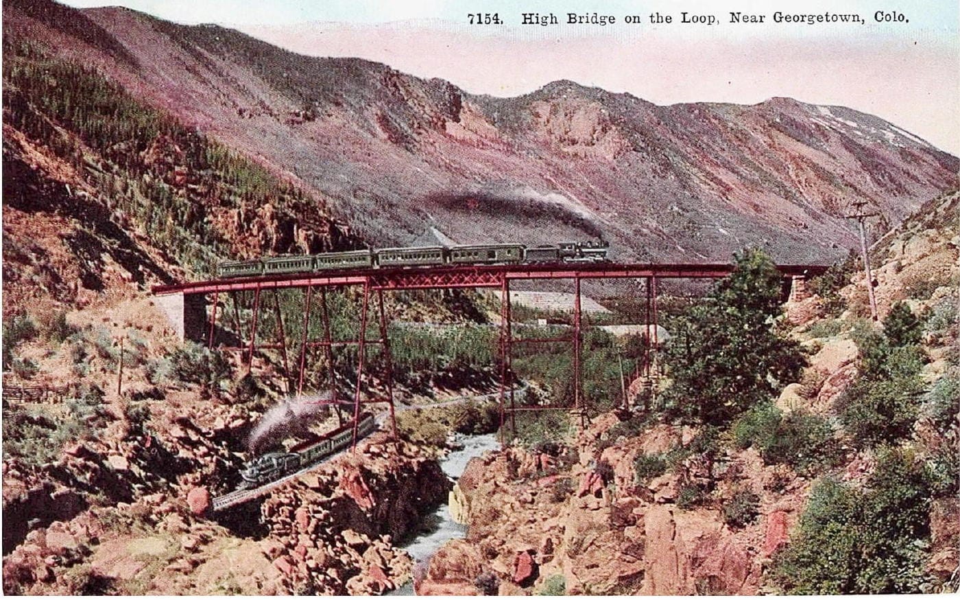
The 300’ long curving viaduct was on a 2% grade and crossed over itself 74’ above the track below. This rendition is fairly accurate, except for the two trains, each drawn in by hand.
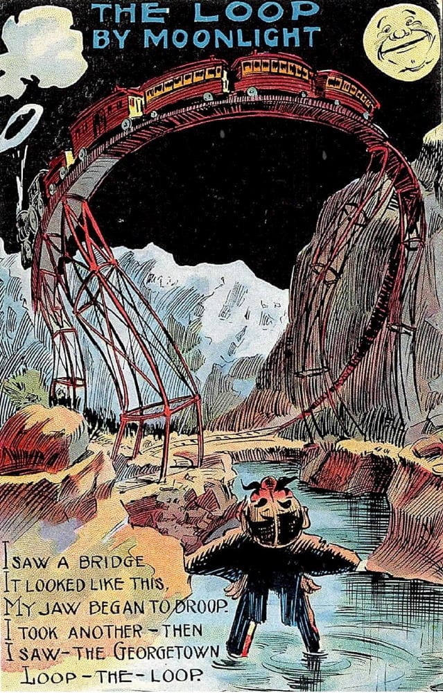
The Georgetown Loop viaduct was considered a pretty awesome structure during its day and prompted this wildly imaginative and death-defying version.
Of course, the reconstructed Georgetown Loop can be ridden today.
Many thanks to Bill Robie for sharing his knowledge and his archive!

)