Public Health References
CDC * Colorado * Jefferson County * City of Golden
As I mentioned last Friday, Jeffco Public Health has changed the way they’re presenting stats; they’ve removed the “suspected cases” from the count. For that reason, this week’s numbers are lower than last week’s, but from now on I’ll post the same data items every day, comparing them to the previous day.
Here’s something many people have been asking for: the number shown below for “Golden” now represents the residents within the City limits of Golden. If you live in one of the surrounding unincorporated neighborhoods (Fairmount, Applewood, Pleasant View, Lakota Hills, etc.) you can see the numbers for your specific area by clicking on the Geography tab and scrolling down to the Neighborhoods map.
Cases in Jeffco
Last Friday: 2455 Tuesday: 2479
Deaths in Jeffco
Last Friday: 197 Tuesday: 198
Ever Hospitalized in Jeffco
Last Friday: 408 Tuesday: 411 (currently 18)
Recovered
Tuesday: 2163
Known Cases in Golden
Last Friday: 107 Tuesday: 110
The Safer at Home protocol is in effect. Check the City’s site to learn more about what that entails. Everyone is still requested to wear a mask that covers the nose and mouth when leaving the house. City and County fire restrictions are in place. Clear Creek is open for Kayaks and Canoes. Learn more….
Virtual Golden
7:30AM Downtown Merchants Association Meeting
10AM Director’s Storytime and Craft with the Railroad Museum
10:15AM Baby & Toddler Time with the Library
6PM Mines Community Meeting
Mines active construction project update
‒ 14th Street (Maple – Illinois)
‒ Parking Garage/Classroom Building (14th and Maple Street)
‒ Spruce Hall (19th and Illinois Street)
‒ Jackson Hall – Partnership (1750 Jackson Street)
‒ Utility Infrastructure Improvements
Master Plan Capital Projects On Hold
‒ Sub-Surface Frontiers Research Building (18th & Cheyanne)
‒ Parking Garage Washington/18th
‒ Beck Venture Center Washington/18th
‒ Early Childhood Development Center (Mines Park 19th & Tangent Way)
Projects In Design
‒ Labriola Innovation Hub – OZ Architecture Schematic Design Presentation
Questions/discussion
Join from PC, Mac, Linux, iOS or Android: https://mines.zoom.us/j/91015419485
7PM Parks, Recreation and Museums Advisory Board
Apex Discussion – Mary Ann Bonnell – Jefferson County Open Space
South Table Mountain Discussion
North and South Table Mountain Survey Work Discussion
Tin Cup Update
21-22 Capital Improvement Plan – Attachment of 19-20 approved projects
COVID-19 Departmental Update
Golden History Moment
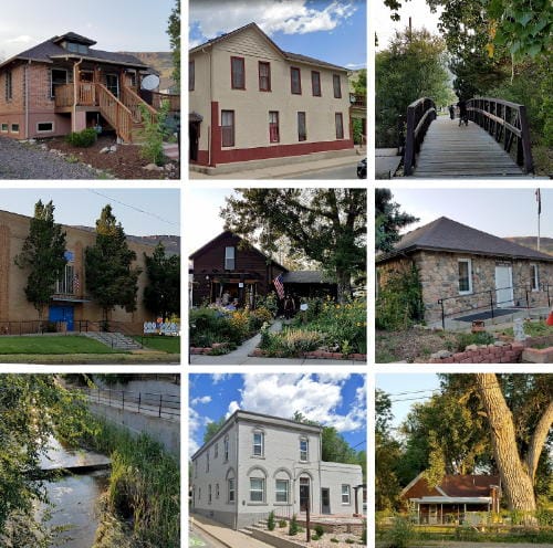
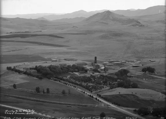
What exactly is Goosetown? There isn’t really an exact definition–it’s not an officially designated district. Roughly speaking, it’s the area north of the Creek, south of Highway 58, and east of Ford Street. It includes the Coors Office Building and parking lots that the City recently purchased. The other chief buildings in the neighborhood are the Golden Masonic Temple, the American Legion hall, Goosetown Events Center, Golden Well Being Collective, and the Burgess House.
David Wall, who may have been Golden’s very first settler, set up a vegetable garden in that area in the spring of 1859. He dug a ditch from Tucker Gulch to his field, thus earning two titles–“the father of Colorado agriculture” and “the father of Colorado irrigation.”
In 1870, the Colorado Central Railroad came to town. Having a railroad put Golden on the map: because of it, we were able to develop significant industry and commerce. The Colorado Central’s roundhouse, machine shop, and freight depot were built in the Goosetown area, and many boarding houses and homes were soon built in the vicinity to support the railroad workers.
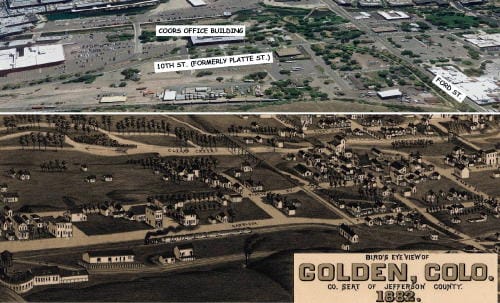
The Colorado Central was built to service the mountain mining towns (Blackhawk, Central City, Idaho Springs, Georgetown, etc.) as well are transporting freight and people between Denver and Golden. By the 1930s, automobiles and trucks were taking the place of railroads, and the railroad employed fewer and fewer people. After World War II, Coors began a tremendous expansion, and the Goosetown neighborhood slowly yielded to Coors offices and parking lots.
Why was it called “Goosetown?” I’ve heard a couple different answers to that question. One is that the brewery kept a flock of geese, and they wandered around the neighborhood, honking. The other answer is that the women of the neighborhood, many foreign-born, kept up a steady stream of chatter, unintelligible to those who only spoke English.

